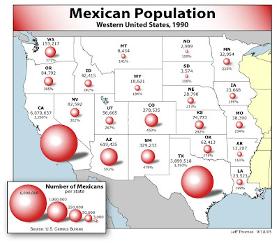
This Proportional Circle Map is indicating the Mexican population within the western United States in 1990. The various sizes of the circles indicate the population size within particular areas. Also as a Thematic Map the proportional circles reflect we see the theme of Mexican population across the entire area.
No comments:
Post a Comment